
1
Cabrillo Statue and Bay Overlook
Loading destination. Pulling the current destination verdict. This detail route is still resolving live conditions, scoring evidence, and fallback guidance.

Southern Coast
01 · The call
Good with cautionWhy now
Spring coastal weather.
Watch out
Heat Advisory issued July 28 at 1:56AM PDT until August 2 at 8:00PM PDT by NWS San Diego CA
Plan B
Keep the trip anchored around Point Loma with a shorter loop through Cabrillo Statue and Bay Overlook and Old Point Loma Lighthouse.
Why now
Spring coastal weather.
Watch out
Heat Advisory issued July 28 at 1:56AM PDT until August 2 at 8:00PM PDT by NWS San Diego CA
Plan B
Keep the trip anchored around Point Loma with a shorter loop through Cabrillo Statue and Bay Overlook and Old Point Loma Lighthouse.
02 · The story
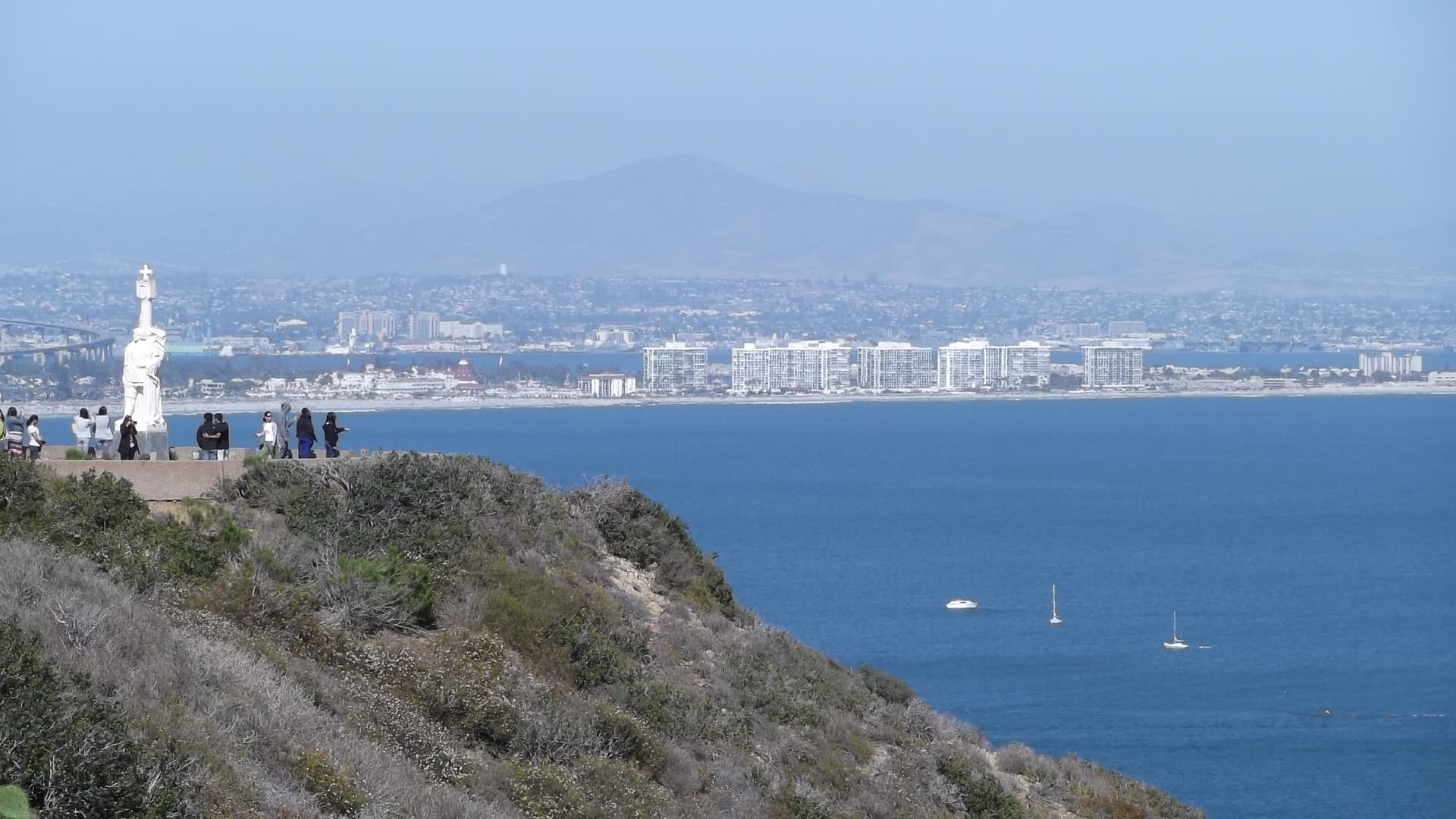
Point Loma monument guide
Cabrillo National Monument is not a big backcountry park.
Point Loma monument guide
Cabrillo National Monument is not a big backcountry park.
Field notes
Sneaker waves and a rising tide. Large waves can run farther up the rocks than expected, and the tide can rise behind you and cut off your exit.
03 · Highlights
Cabrillo Statue and Bay Overlook

Old Point Loma Lighthouse

Cabrillo Tidepools
Oceanside Trail

Bayside Trail
Selected stop
Cabrillo Tidepools
The most timing-sensitive payoff. Build this around a suitable low tide, sturdy shoes, and enough patience for lower-area parking.
04 · The window
05 · The conditions
Current weather
75F day, 70F night
0% chance of rain
10 mph wind
Nearest towns: Ventura · Temecula
Updated Jul 28, 2026, 12:10 PM
06 · On the ground
Road and weather data checked Jul 28, 2026, 12:10 PM
Official alerts
Last checked
Jul 28, 2026, 12:10 PM
* WHAT...High temperatures in the mid 80s to around 90 for the mesas and other higher coastal terrain expected. * WHERE...San Diego County Coastal Areas. * WHEN...From 10 AM Friday to 8 PM PDT Sunday. * IMPACTS...Hot temperatures may cause heat illnesses.
* WHAT...For the Beach Hazards Statement, 3-6 feet with sets to 7 feet expected. For the Coastal Flood Advisory, minor coastal flooding expected. For the High Surf Advisory, large breaking waves of 5-8 feet with sets up to 9 feet on south-southwest facing beaches and 3-6 feet on west-facing beaches. * WHERE...San Diego County Coastal Areas and Orange County Coastal Areas. * WHEN...For the Beach Hazards Statement, through Wednesday afternoon. For the Coastal Flood Advisory, from 5 PM Wednesday to 3 AM PDT Saturday. For the High Surf Advisory, from 5 PM Wednesday to 5 PM PDT Saturday. * IMPACTS...Flooding of lots, parks, and roads with only isolated road closures expected. Dangerous swimming and surfing conditions and localized beach erosion. Breaking waves can sweep people off jetties and docks, and into dangerous seas. * ADDITIONAL DETAILS...A long period southerly swell of 3 feet at 17 seconds continues through Wednesday. A higher amplitude swell associated with Hurricane Genevieve of around 5 feet at 14 seconds builds late Wednesday into Thursday. Swell and associated surf look to subside late Saturday into Sunday.
Next step
On the water
Cabrillo tide pools
7 kt · gust 7 · W
The Point
6 kt · gust 6 · W
Bay side
6 kt · gust 6 · W
Outer swell
5.1 ft @ 13s
On the water
Wind's even along the coast this window — no calm side to pick.
Cabrillo tide pools
7 kt · gust 7 · W
The Point
6 kt · gust 6 · W
Bay side
6 kt · gust 6 · W
Outer swell
5.1 ft @ 13s
* WHAT...For the Beach Hazards Statement, 3-6 feet with sets to 7 feet expected. For the Coastal Flood Advisory, minor coastal flooding expected. For the High Surf Advisory, large breaking waves of 5-8 feet with sets up to 9 feet on south-southwest facing beaches and 3-6 feet on west-facing beaches. * WHERE...San Diego County Coastal Areas and Orange County Coastal Areas. * WHEN...For the Beach Hazards Statement, through Wednesday afternoon. For the Coastal Flood Advisory, from 5 PM Wednesday to 3 AM PDT Saturday. For the High Surf Advisory, from 5 PM Wednesday to 5 PM PDT Saturday. * IMPACTS...Flooding of lots, parks, and roads with only isolated road closures expected. Dangerous swimming and surfing conditions and localized beach erosion. Breaking waves can sweep people off jetties and docks, and into dangerous seas. * ADDITIONAL DETAILS...A long period southerly swell of 3 feet at 17 seconds continues through Wednesday. A higher amplitude swell associated with Hurricane Genevieve of around 5 feet at 14 seconds builds late Wednesday into Thursday. Swell and associated surf look to subside late Saturday into Sunday.
* WHAT...For the Beach Hazards Statement, 3-6 feet with sets to 7 feet expected. For the Coastal Flood Advisory, minor coastal flooding expected. For the High Surf Advisory, large breaking waves of 5-8 feet with sets up to 9 feet on south-southwest facing beaches and 3-6 feet on west-facing beaches. * WHERE...San Diego County Coastal Areas and Orange County Coastal Areas. * WHEN...For the Beach Hazards Statement, through Wednesday afternoon. For the Coastal Flood Advisory, from 5 PM Wednesday to 3 AM PDT Saturday. For the High Surf Advisory, from 5 PM Wednesday to 5 PM PDT Saturday. * IMPACTS...Flooding of lots, parks, and roads with only isolated road closures expected. Dangerous swimming and surfing conditions and localized beach erosion. Breaking waves can sweep people off jetties and docks, and into dangerous seas. * ADDITIONAL DETAILS...A long period southerly swell of 3 feet at 17 seconds continues through Wednesday. A higher amplitude swell associated with Hurricane Genevieve of around 5 feet at 14 seconds builds late Wednesday into Thursday. Swell and associated surf look to subside late Saturday into Sunday.
CORRAL is an active wildfire roughly 43 miles from Cabrillo National Monument. Current incident context: San Diego County, 1 acres.
MATEO is an active wildfire roughly 56 miles from Cabrillo National Monument. Current incident context: San Diego County, 1,335 acres, 100% contained. 10 Miles N from Camp Pendleton, CA

Southern Desert
Joshua Tree

