
1
Tunnel View
Loading destination. Pulling the current destination verdict. This detail route is still resolving live conditions, scoring evidence, and fallback guidance.
Sierra Nevada
01 · The call
Good with cautionWhy now
Waterfalls are peaking.
Watch out
Nearby wildfire: DOVE (50 miles away)
Plan B
Keep the trip anchored around Yosemite Valley or El Portal with a shorter loop through Tunnel View and Lower Yosemite Fall.
Why now
Waterfalls are peaking.
Watch out
Nearby wildfire: DOVE (50 miles away)
Plan B
Keep the trip anchored around Yosemite Valley or El Portal with a shorter loop through Tunnel View and Lower Yosemite Fall.
02 · The story

Yosemite Valley guide
Yosemite Valley is not just one viewpoint.
Yosemite Valley guide
Yosemite Valley is not just one viewpoint.
Field notes
Bear-smart camp setup. Yosemite bears are used to busy campgrounds, so treat food storage as part of camp setup.
03 · Highlights
Tunnel View
Lower Yosemite Fall

Cook’s Meadow Loop

Glacier Point

Valley View
Selected stop
Cook’s Meadow Loop
A flat meadow walk that gives the group Half Dome, Yosemite Falls, Sentinel Rock, and open valley space without turning the day into a hike.
04 · The window
05 · The conditions
Current weather
78F day, 57F night
0% chance of rain
10 mph wind
Nearest towns: El Portal · Mariposa
Updated Jul 28, 2026, 12:10 PM
06 · On the ground
Before you go
Road and weather data checked Jul 28, 2026, 12:10 PM
Official alerts
Last checked
Jul 28, 2026, 12:10 PM
DOVE is an active wildfire roughly 50 miles from Yosemite Valley. Current incident context: Tuolumne County, 223 acres, 10% contained. 1 Miles S from SONORA, CA
GROUSE is an active wildfire roughly 37 miles from Yosemite Valley. Current incident context: Tuolumne County, 5 acres.
When the park is very busy, you can get updates on current traffic conditions in Yosemite by texting ynptraffic to 333111.
Next step
Across the park
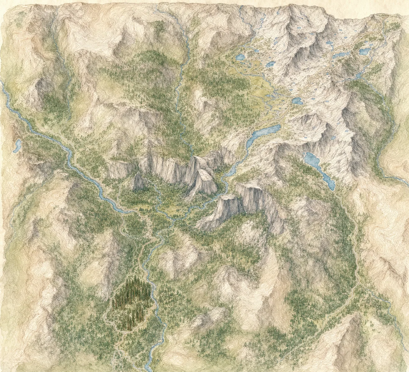
Valley Visitor Center
88° · 4,000 ft
Tunnel View
85° · 4,400 ft
Glacier Point
75° · 7,200 ft
Tuolumne Meadows
73° · 8,600 ft
Tioga Pass
70° · 9,900 ft
Mariposa Grove
76° · 6,500 ft
Across the park
About 18° colder up high — Valley Visitor Center 88°, Tioga Pass 70°.
Across the park · by elevation
Temp · wind
Valley Visitor Center
88° · 4,000 ft
Tunnel View
85° · 4,400 ft
Glacier Point
75° · 7,200 ft
Tuolumne Meadows
73° · 8,600 ft
Tioga Pass
70° · 9,900 ft
Mariposa Grove
76° · 6,500 ft
Valley Visitor Center 88° · Tioga Pass 70° — colder up high.
No gas inside the park — fuel up on the way in.
FIELDS is an active wildfire roughly 51 miles from Yosemite Valley. Current incident context: Merced County, 1,280 acres, 85% contained. 10 Miles NW from SNELLING, CA

Central Sierra
Huntington Lake

